Zams - Falterschein - Kronburg - Zams
Hiking & mountain tour
Leisure and Recreational Hiking
From the car park at the Venetbahn valley station, the circular trail leads via Anreit, Rifenal, Grist and Falterschein via Kronburg and the Zammer Patscheid back to the starting point.
Medium
15,00 km
485 m
05:00 h
Medium
Route
15,00 km
485 m
05:00 h
1238 m
Starting Point
Venetbahn Valley Station
End Point
Venetbahn Valley Station
Description
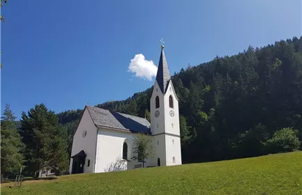
From the Venetbahn valley station, follow the former railway line to the centre of Zams. Follow the Way of St James up to Anreit and Rifenal. Continue via Schwaighof to Grist and from there on the road to Flaterschein. At the church, follow the signs down to Kronburg. From there, follow the forest path back towards Rifenal until you reach the junction through the Zammer Patscheid after approx. 500 metres. Here it goes downhill to the Landecker Tunnel. Then follow the Inn cycle path until you reach the hospital car park. Here you hike up to the hospital and along the former railway line back to the valley station.
Best Season
Jan
Feb
Mar
Apr
May
Jun
Jul
Aug
Sep
Oct
Nov
Dec
Elevation Profile & Characteristics
Skill Level
Endurance
Amenities & Features
Circular hike
Path Conditions
Asphalt, forest roads, forest and meadow trails
Public Transport
From the Landeck-Zams train station, take Line 1 to the Venetbahn stop. Check the SCHEDULE.
Impressions