Krahberg - Glanderspitze - Gogles Alm
Alpine Hiking
Hiking & mountain tour
Hut & alpine pasture hiking
Leisure and Recreational Hiking
The circular hike leads from the cable car mountain station on the Krahberg 2,208 m to the Glanderspitze 2,505 m, from there down to the Gogles Alm 2,017 m and finally back to the mountain station of the Venet cable car.
Medium
9,50 km
545 m
04:15 h
Medium
Route
9,50 km
545 m
535 m
04:15 h
2505 m
Starting Point
Venetbahn Mountain Station
End Point
Venetbahn Mountain Station
Important Information
The Krahberg can be reached via the Venet Cable Car.
Description
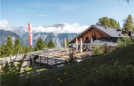
This circular hike with cable car support focuses on the fabulous views and the summit experience of the 2,505 m high Glanderspitze (Venet). You can also experience Tyrolean cosiness and hospitality at the Gogles Alm mountain hut.
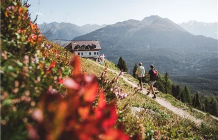
First, take the Venetbahn cable car up to the Krahberg. From the mountain station, you hike eastwards on a section of the E5 long-distance hiking trail across meadows and alpine pastures on a path to the summit with the cross (walking time approx. 1 h 45 min). The last section runs over a meadow ridge and through scree. The route then descends quite quickly and directly in serpentines. Here you meet the path (variant of the E5) that leads from the Gogles Alm to the Larcher Hütte. Walk gently downhill on this path to the Gogles Alm (2,017 m).
For the way back, take the marked path to the Venetbahn mountain station. Just before your destination, the trail joins the original route, which takes you effortlessly back to the mountain station.
First, take the Venetbahn cable car up to the Krahberg. From the mountain station, you hike eastwards on a section of the E5 long-distance hiking trail across meadows and alpine pastures on a path to the summit with the cross (walking time approx. 1 h 45 min). The last section runs over a meadow ridge and through scree. The route then descends quite quickly and directly in serpentines. Here you meet the path (variant of the E5) that leads from the Gogles Alm to the Larcher Hütte. Walk gently downhill on this path to the Gogles Alm (2,017 m).
For the way back, take the marked path to the Venetbahn mountain station. Just before your destination, the trail joins the original route, which takes you effortlessly back to the mountain station.
Best Season
Jan
Feb
Mar
Apr
May
Jun
Jul
Aug
Sep
Oct
Nov
Dec
Elevation Profile & Characteristics
Skill Level
Endurance
Path Conditions
Alpine and meadow trails.
Impressions