Folder License (MTB 705)
Mountainbike tour
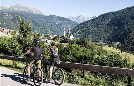
From the Venetbahn car park, the route leads via the Falterscheinrunde to Schönwies. From there, the route follows the country road up to Imsterberg, where you follow the Imsterberger Venetalm circuit to the finish. Return along the same route to Schönwies and from there along the Inn cycle path to Zams and the starting point.
Hard
48,00 km
1810 m
03:30 h
Hard
Route
48,00 km
1810 m
03:30 h
1995 m
Starting Point
Venetbahn Talstation
End Point
Venetbahn Talstation
Description
From the Venetbahn car park, the signposted route (MTB 705) leads to the Riefengebäude, from there on the tarmac road up to Rifenal and on to Falterschein. From there, a gravel path leads down to Obsaurs and then along the tarmac road down to Schönwies. Pass the edge of the forest through Schönwies in the direction of Imst to the end of the village (Ried district). From there, the tarmac road leads up to Imsterberg. There you meet the signposted cycle path (MTB 605), which leads to the Imsterberger Venetalm. The return journey follows the same route to Schönwies/Ried, from there to the centre of Schönwies and along the Inn cycle path or, from Schönwies parish church, along the signposted mountain bike trail (MTB 705) back to the starting point at the Venetbahn valley station.
Best Season
Jan
Feb
Mar
Apr
May
Jun
Jul
Aug
Sep
Oct
Nov
Dec
Elevation Profile & Characteristics
Skill Level
Endurance
Amenities & Features
Circular hike
Path Conditions
Asphalt, Forstweg