3) Via Claudia Augusta / Kaltenbrunn pilgrimage route NPKG
On historic trails – experience history step by step!
Easy
4,76 km
43 m
01:50 h
Easy
Route
4,76 km
43 m
296 m
01:50 h
1068 m
Starting Point
Fließ Lafreins
End Point
Landeck
Description
The Via Claudia Augusta was a Roman trade and transport route. Today, parts of it serve as a hiking trail, for example from Landeck to Fließ, passing historic sites such as the Fließer Platte, where traces of Roman carts are still visible.
Best Season
Jan
Feb
Mar
Apr
May
Jun
Jul
Aug
Sep
Oct
Nov
Dec
Elevation Profile & Characteristics
Skill Level
Endurance
Amenities
Sturdy shoes, weather-appropriate clothing, sunscreen, sufficient water, and snacks if necessary. Depending on the season, rain gear or cold weather protection is recommended.
Instructions
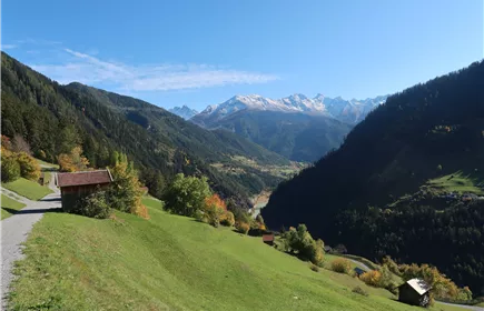
The Via Claudia Augusta was not only an important transport and trade route, but also a cultural and communication route that connected different peoples and regions. Settlements, forts, temples, thermal baths, and bridges sprang up along the road. Many finds from Roman times can be seen in museums along the route, for example in the Fließ Archaeological Museum and the Via Claudia Augusta Documentation Center. The Kaltenbrunn pilgrimage route also runs partly along the Via Claudia Augusta. The section from Landeck to Fließ is one of the most beautiful and impressive routes in the Tyrolean Oberland. Along ancient paths lined with heat-loving hedges and shrubs, you will also pass impressive witnesses to Alpine history, such as the Fließer Platte, where traces of Roman carts are still visible today.
Path Conditions
Hiking trail, forest road, road
Public Transport
From Landeck:
Take bus line 240 to the “Fließ Ort” stop. From the village center, it is then about a 10-minute walk along Via Claudia Augusta towards Landeck to the starting point.
From Fließ: From the village center, it is about a 10-minute walk along Via Claudia Augusta towards Landeck to the starting point.
(Please note the timetable)
Take bus line 240 to the “Fließ Ort” stop. From the village center, it is then about a 10-minute walk along Via Claudia Augusta towards Landeck to the starting point.
From Fließ: From the village center, it is about a 10-minute walk along Via Claudia Augusta towards Landeck to the starting point.
(Please note the timetable)
Parking
From Fliess:
Take a leisurely stroll along the Via Claudia Augusta towards Landeck until you reach the starting point.
From Landeck:
Follow the B180 (Reschenstraße) to “Fliess Neuer Zoll” and turn left onto the L17 (Piller Landesstraße). Follow the L17 to Mühlbach and continue straight ahead to the center of the village of Fließ. From there, it is only a few minutes' walk along the Via Claudia Augusta towards Landeck to the starting point in Lafreins.
From Wenns:
Take the L17 (Piller Landesstraße) to the Brandopferplatz am Gachenblick, keep
right and follow the road towards Fließ. In the district of Mühlbach, turn right and drive into the village center. From there, you can easily reach the starting point in about 10 minutes on foot
via the Via Claudia Augusta towards Landeck.
There are several parking options available in the center of Fließ. From there, you can reach the starting point in a few minutes on foot via Via Claudia Augusta in the direction of Landeck.
Take a leisurely stroll along the Via Claudia Augusta towards Landeck until you reach the starting point.
From Landeck:
Follow the B180 (Reschenstraße) to “Fliess Neuer Zoll” and turn left onto the L17 (Piller Landesstraße). Follow the L17 to Mühlbach and continue straight ahead to the center of the village of Fließ. From there, it is only a few minutes' walk along the Via Claudia Augusta towards Landeck to the starting point in Lafreins.
From Wenns:
Take the L17 (Piller Landesstraße) to the Brandopferplatz am Gachenblick, keep
right and follow the road towards Fließ. In the district of Mühlbach, turn right and drive into the village center. From there, you can easily reach the starting point in about 10 minutes on foot
via the Via Claudia Augusta towards Landeck.
There are several parking options available in the center of Fließ. From there, you can reach the starting point in a few minutes on foot via Via Claudia Augusta in the direction of Landeck.
Author's Tip
Take a look at the Fließer Platte – here you can still see traces of Roman carts.